
THE EAST COAST SERPENTINE BARRENS
THROUGH TIME
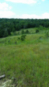
Serpentine Barrens are a grassland/savanna ecosystem found in extremely limited distribution worldwide. They are especially uncommon and endangered on the eat coast of North America. The defining factor in the environment is serpentine rock, created and pushed to the surface ages ago by plate tectonic movement and the heaving and shifting of the ancient sea floor. Current conditions are threatening floor and fauna native to the serpentine barrens on the Habonim Dror Camp Moshava property. The site has eleven Maryland plant species of concern, including three species classified as threatened or endangered. Armed with a restoration and management plan, Camp Moshava is determined to save them. Below is a timeline of events which formed the Serpentine Barrens as we know them today.

The soil characteristics of serpentine barrens are derived from serpentine bedrock which was once part of the ocean floor. A slow but powerful collision of the North American and African oceanic plates 450 million years ago uplifted a group of ultramafic rocks from the oceanic mantle. These rocks, when exposed to water and low temperatures, altered to serpentine. During this continental collision, most of the African Plate slid under the North American Plate. However, some fragments of the ultramafic rocks from the oceanic floor were scraped off, leaving behind long, wide swathes of serpentine (called ophiolites) wedged into the eastern North American plate boundary.
Millions of years later, when the continents separated again, these fragments of serpentine remained behind. Serpentinite, a metamorphic rock, consists of hydrous magnesium-iron silicate minerals. This composition contributes to its greenish "serpentine-like" appearance.
The soil that forms over serpentinite bedrock has very unusual characteristics. Chemically, it has unusually high levels of magnesium and very low levels of calcium and essential nutrients (e.g., potassium and phosphorus). This unique chemistry presents a challenge for many plants to thrive, as most plants need more calcium than this soil provides.
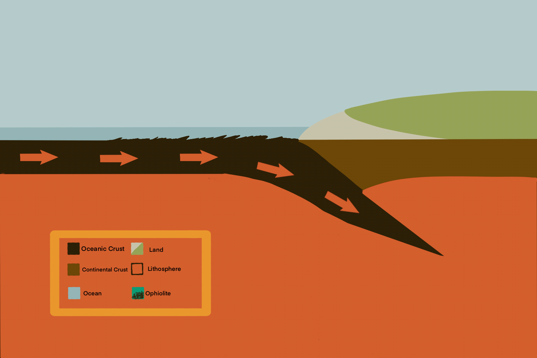
Ophiolite Formation
Video by L. Conaway (2021), Stephenson University
Want to dive deeper underground?
Click here for current research on Maryland Serpentine Barrens geology. (external link)

CLIMATE SHIFT
For the past 20,000 years, the climate of North America has progressed through a series of climate changes which have impacted the vegetation found in Maryland. After the last Ice Age (20,000-10,000 years ago), Maryland's climate shifted from a cold, tundra like environment to a warmer and wetter environment. Curing this transition, cold-adapted plants migrated northward and were replaced by warm-adapted species from the south.
This plant migration accelerated during a warm, dry period called the Hypsithermal Interval (8,000-4,000 years ago). A large number of grasses, sedges, and wildflowers of the Great North American Grassland were able to migrate to Maryland. Southern forest species, including oak trees, also migrated into the region as cold-adapted conifers migrated northward. And those grasses, wildflowers, and oaks that were able to tolerate the infertile magnesium-laden soils, colonized the serpentine regions.
Interested in the connection between climate and serpentine vegetation?
Click here for recent literature review. (external link)

EARLY HUMAN IMPACT
Over the last 10,000-12,000 years human also migrated eastward, along with their plant and animal counterparts, expanding the range of frequent landscape fires. Early Native Americans used landscape fire to drive game while hunting, improve travel, defend settlements, clear land for agriculture, and improve the number and quality of medicinal plants.
Over time, Maryland's climate gradually became wetter, favoring tree growth. However, frequent Native American fires, along with lightening ignited fires, contributed to the plant disturbance that limited the conversion of grassland to woodland forest, thereby preserving the biodiversity of the serpentine savanna grassland ecosystem.
It is believed that the Susquehannock tribe moved into the region in the 1500's. By 1608, the tribe controlled all the major tributaries of the Chesapeake Bay. During the height of their power, most of Northern Maryland and Baltimore, including the serpentine grasslands, served as their hunting grounds. There are historical records of smoke from the Native American landscape fires as early as 1632.
Trade with Europeans was well established even before the first English settlement in the Chesapeake in 1634, and ultimately included agreements which the Swedes, the English, the Dutch, and the French. Unfortunately, due to smallpox and armed conflicts with the Iroquois, the Susquehannocks' power and numbers were greatly diminished by the second half of the 1600's. A treaty with the English in 1652 ceded most of the land of the tribe, including the barrens areas, to the colony of Maryland. By 1697, after a massacre in Pennsylvania, their small numbers were assimilated into Native American tribes in Ohio, and they subsequently lost their identity as a distinct nation.
Are you a history buff?
Click here to discover more about the connection between people and the land. (external link)

MODERN IMPACT
After the Susquehannocks' lost control over the barrens of Maryland and Pennsylvania, the area continued to be used for hunting by several different groups of Native Americans. European settlement of the Maryland barrens began around 1750, after the remaining Native American tribes had been extirpated from the colony.
The open grassland was immediately repurposed as prime grazing lands; the land was also used for timber harvesting of the oaks that grew on the soil. In the early 1800s, chromite was discovered in many of the serpentine barrens in Maryland. By the 1850's, Maryland and Pennsylvania serpentine barrens supplied nearly all of the world's chromite. Although there are no chromite mines on the Cherry Hill Barrens, the reminds of a magnetite mine are nearby on the property.
By the early 1900s, grazing on the grasslands had ceased. Aerial photographs of the Cherry Hill Barrens taken between 1938 and 1986 show progressive loss of grassland as it laid undisturbed. The large barrens area was reduced to just 4 opening that are still present today.
The loss of open savanna grassland at the Cherry Hill Barrens has been documented by aerial photographs since 1935. Click below to see the progressive overgrowth of Virgina Pines and Eastern Red Cedars
FORMATION
